

Basemaps
for Land, Water, and Design
-
![]()
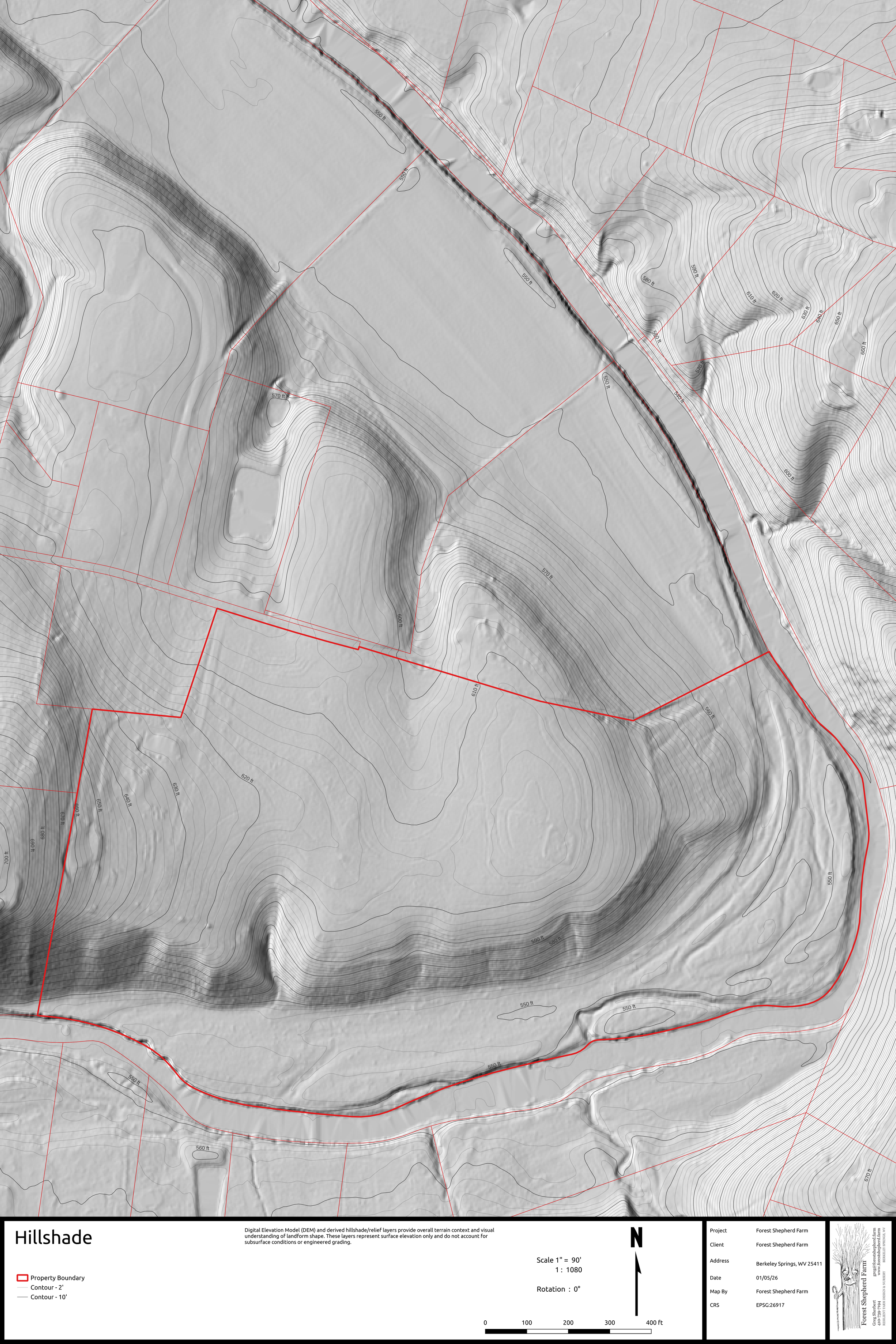
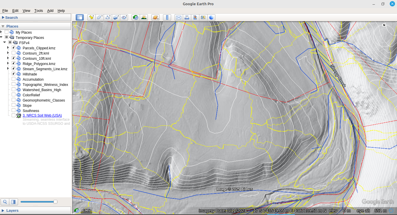
Hillshade
Digital Elevation Model (DEM) and derived hillshade/relief layers provide overall terrain context and visual understanding of landform shape. These layers represent surface elevation only and do not account for subsurface conditions or engineered grading.
-
![]()
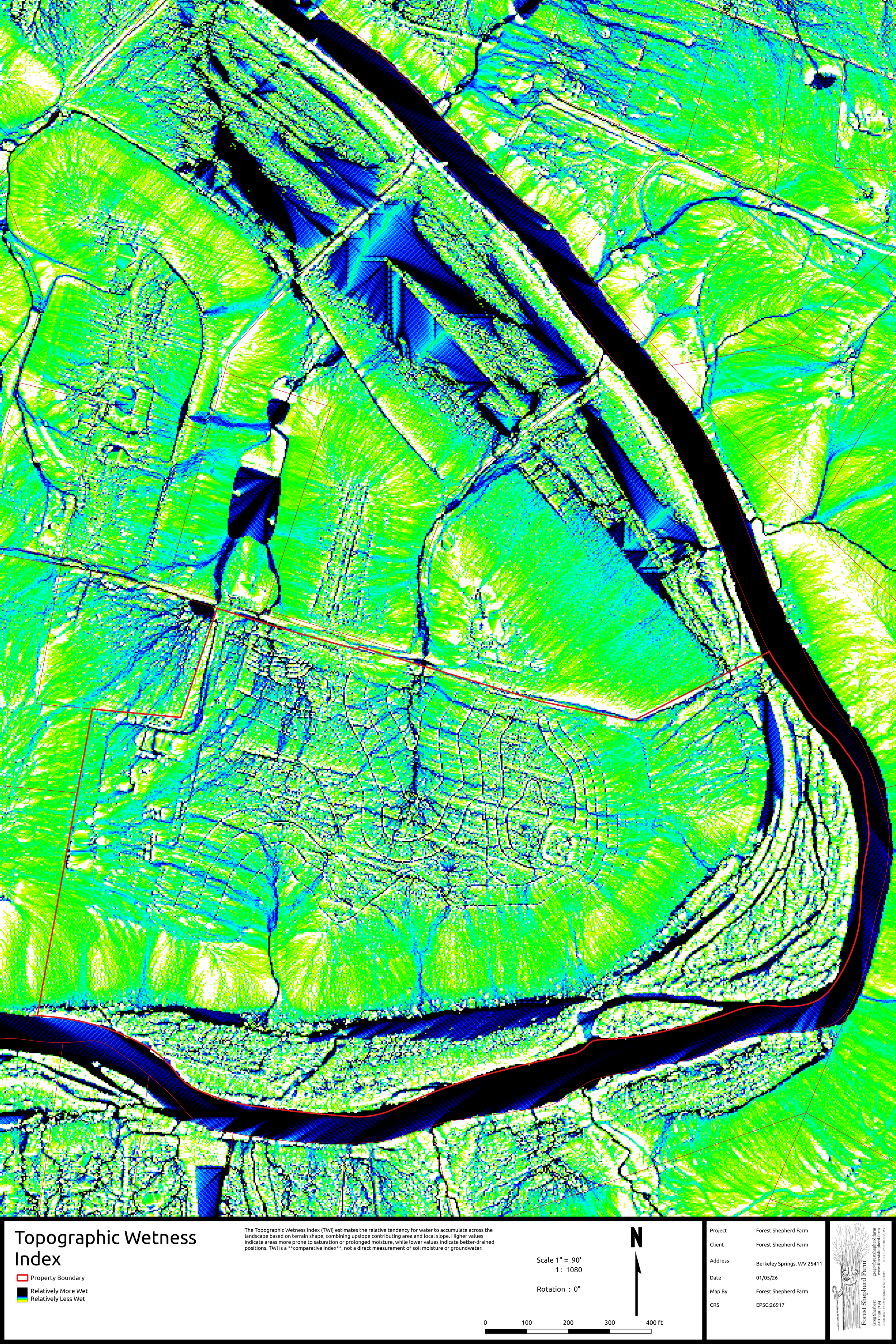
Topographic Wetness Index
The Topographic Wetness Index (TWI) estimates the relative tendency for water to accumulate across the landscape based on terrain shape, combining upslope contributing area and local slope. Higher values indicate areas more prone to saturation or prolonged moisture, while lower values indicate better-drained positions. TWI is a comparative index, not a direct measurement of soil moisture or groundwater.
-
![]()
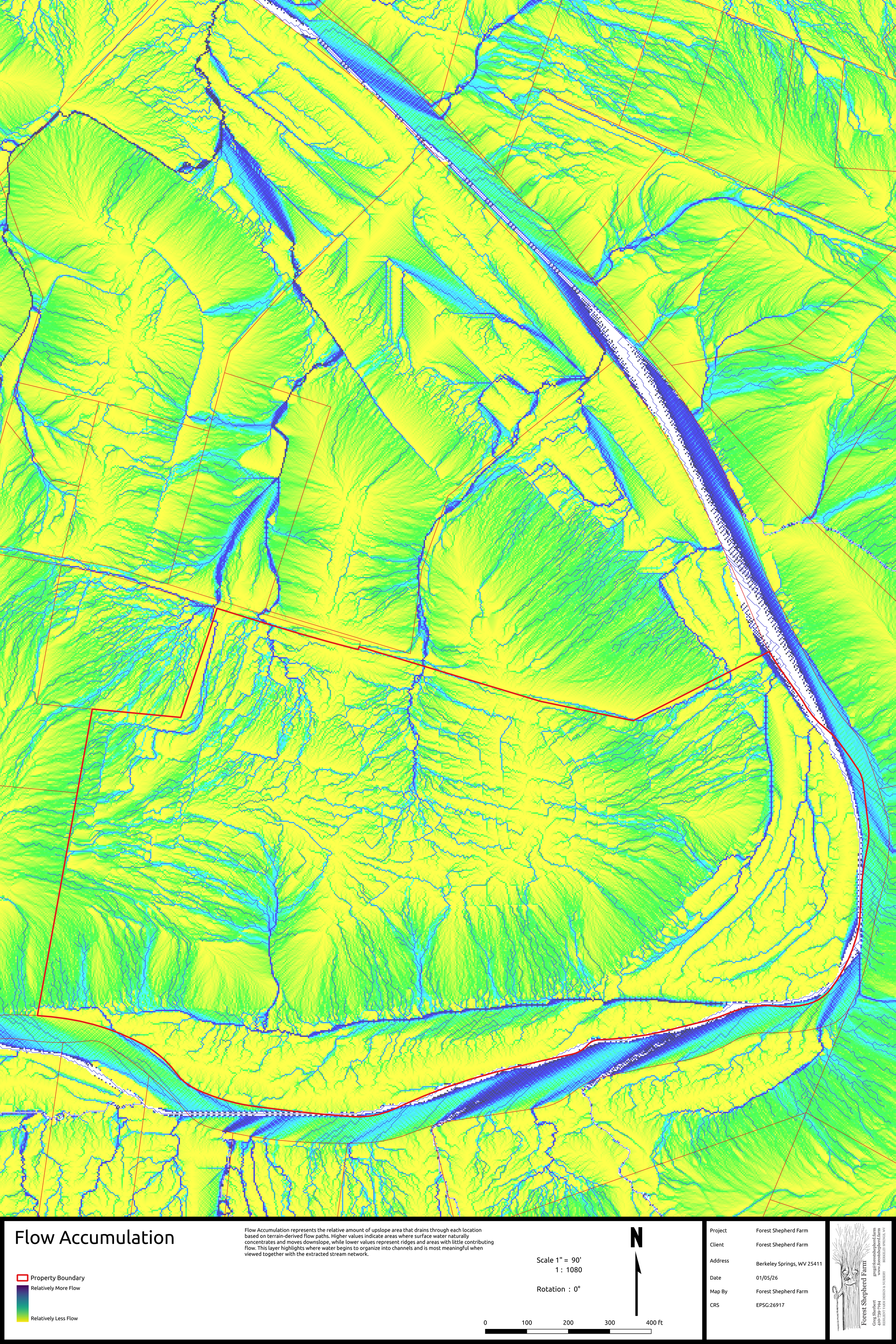
Flow Accumulation
Flow Accumulation represents the relative amount of upslope area that drains through each location based on terrain-derived flow paths. Higher values indicate areas where surface water naturally concentrates and moves downslope, while lower values represent ridges and areas with little contributing flow. This layer highlights where water begins to organize into channels and is most meaningful when viewed together with the extracted stream network.
-
![]()
Watershed Basins
Watershed Basins delineate areas of land that drain to a common downstream point based solely on surface topography. Each basin represents an independent topographic hydrologic unit, illustrating how rainfall and runoff are naturally organized across the landscape. Basin boundaries reflect surface drainage only and do not account for culverts, stormwater infrastructure, or subsurface flow.
-
![]()
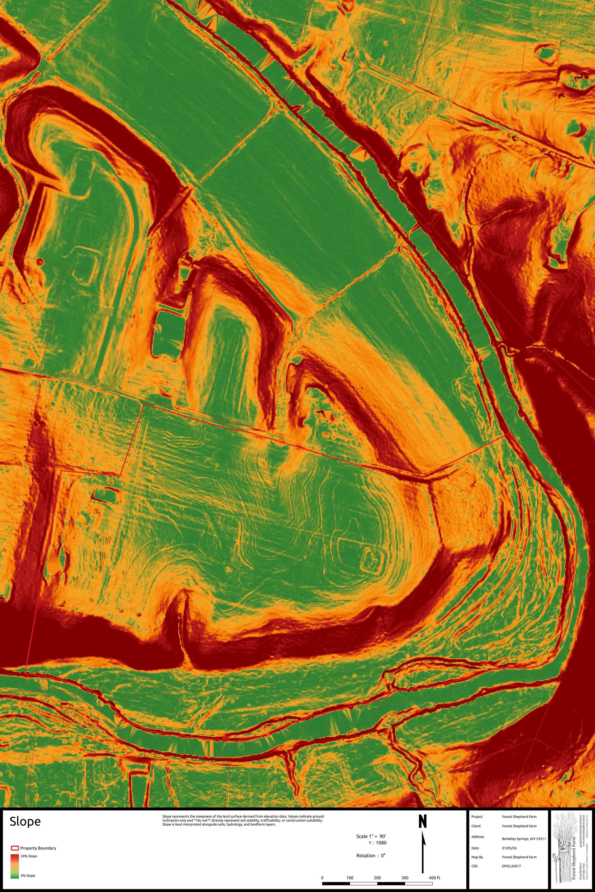
Slope
Slope represents the steepness of the land surface derived from elevation data. Values indicate ground inclination only and do not directly represent soil stability, trafficability, or construction suitability. Slope is best interpreted alongside soils, hydrology, and landform layers.
-
![]()
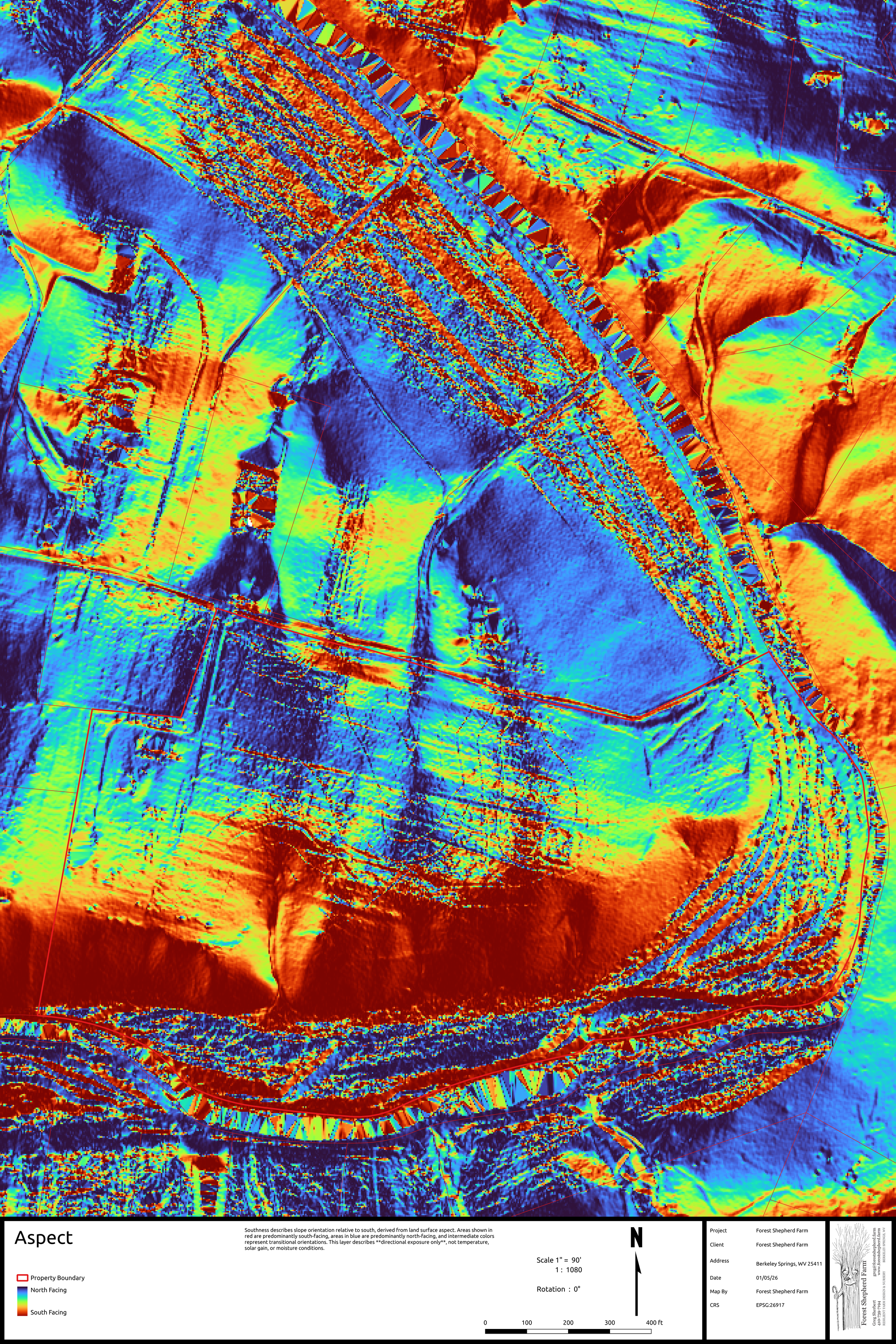
Aspect
Aspect describes slope orientation relative to south, derived from land surface aspect. Areas shown in red are predominantly south-facing, areas in blue are predominantly north-facing, and intermediate colors represent transitional orientations. This layer describes directional exposure only, not temperature, solar gain, or moisture conditions.
-
![]()
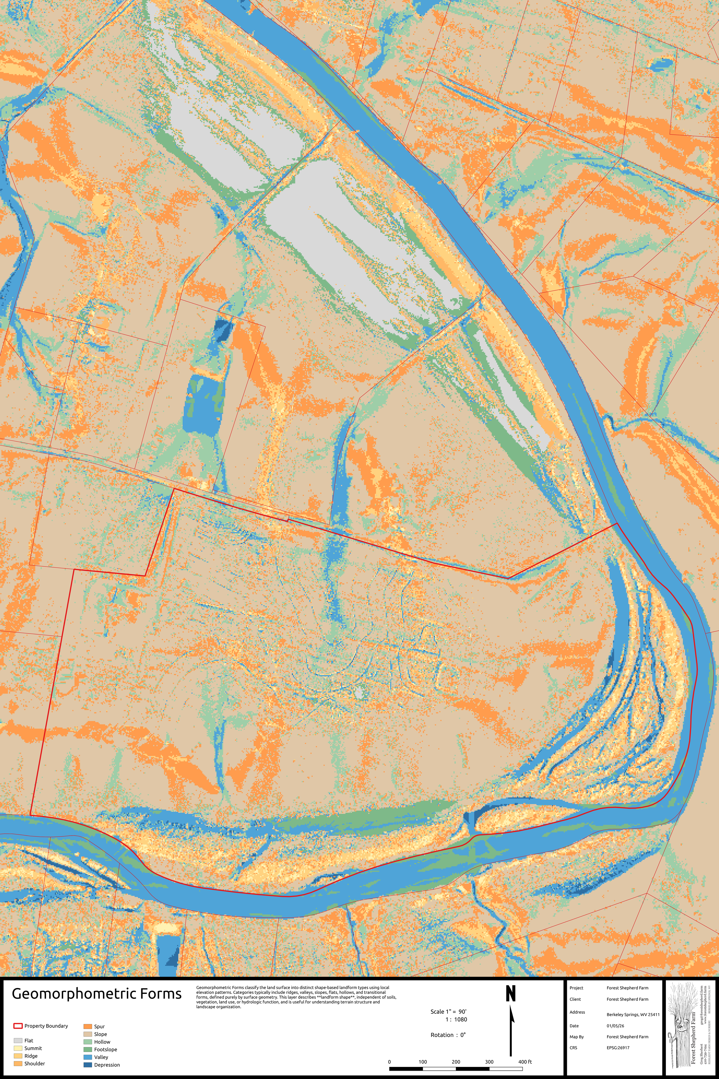
Geomorphometric Forms
Geomorphometric Forms classify the land surface into distinct shape-based landform types using local elevation patterns. Categories typically include ridges, valleys, slopes, flats, hollows, and transitional forms, defined purely by surface geometry. This layer describes landform shape, independent of soils, vegetation, land use, or hydrologic function, and is useful for understanding terrain structure and landscape organization.
-
![]()
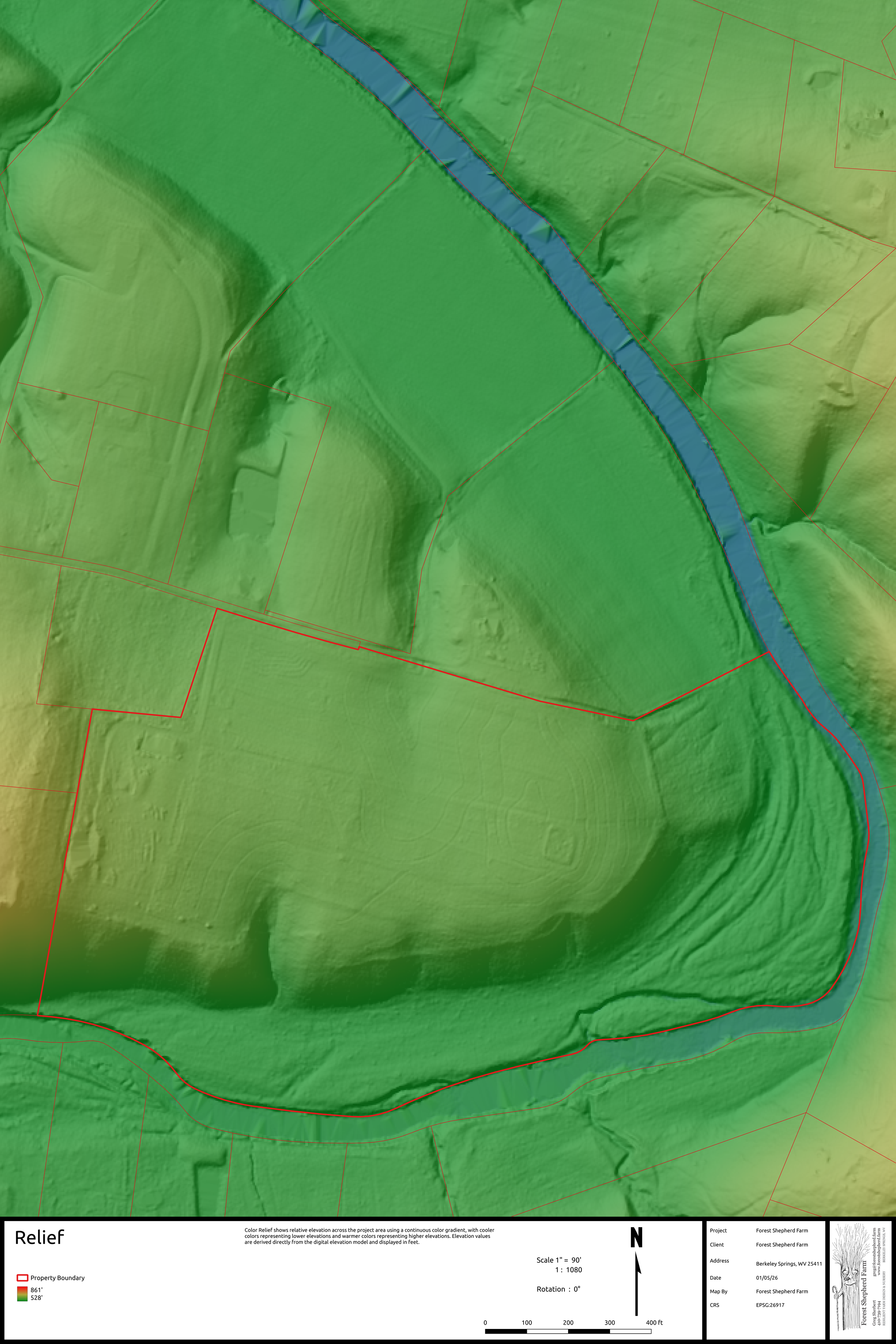
Relief
Color Relief shows relative elevation across the project area using a continuous color gradient, with cooler colors representing lower elevations and warmer colors representing higher elevations. Elevation values are derived directly from the digital elevation model and displayed in feet.
-
![]()
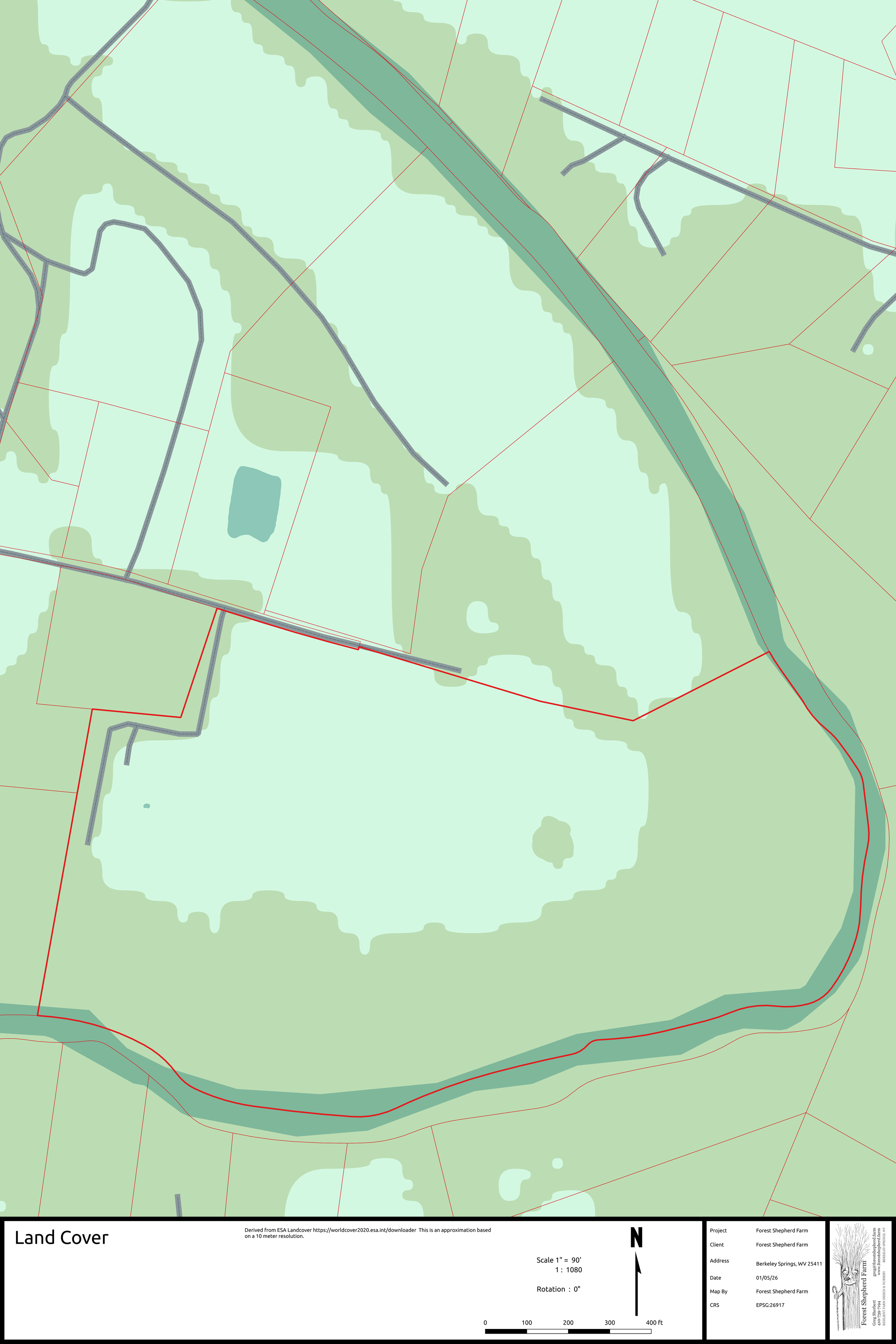
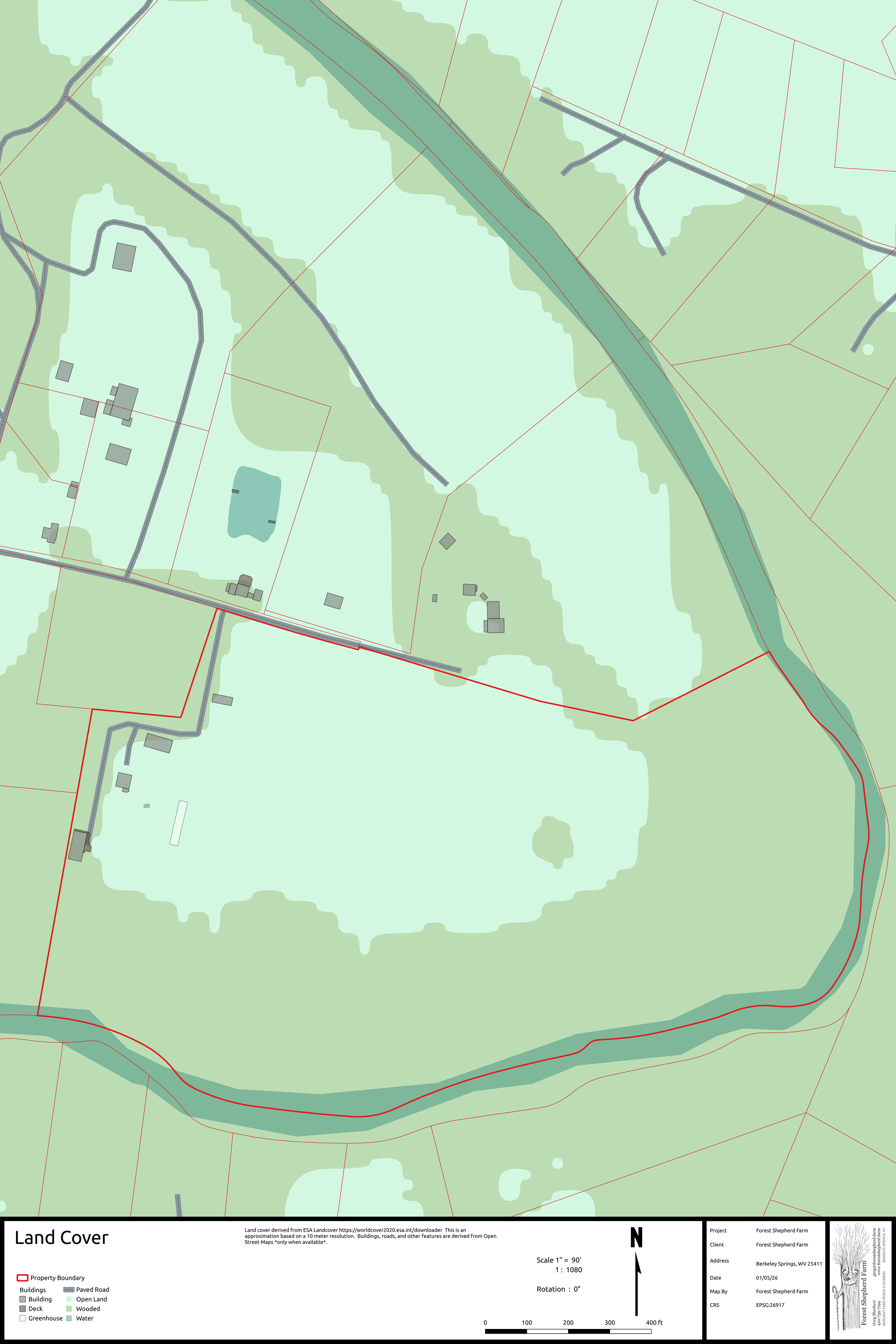
Land Cover
Land cover derived from ESA Landcover https://worldcover2020.esa.int/downloader
This is an approximation based on a 10 meter resolution. Buildings, roads, and other features are derived from Open Street Maps.
Only when available
-
![]()
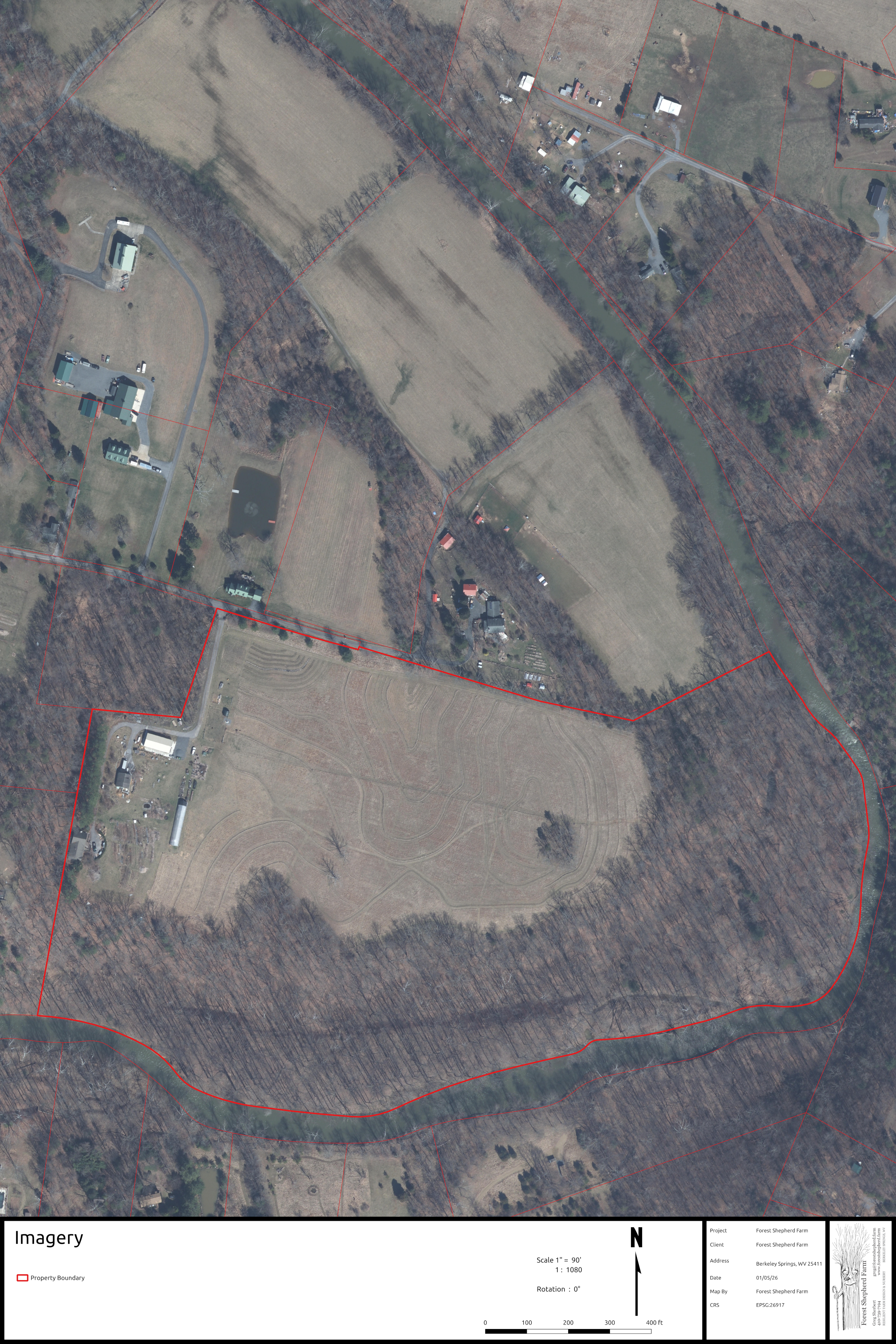
Imagery
Satellite Imagery of the property
Only when available
-
![]()
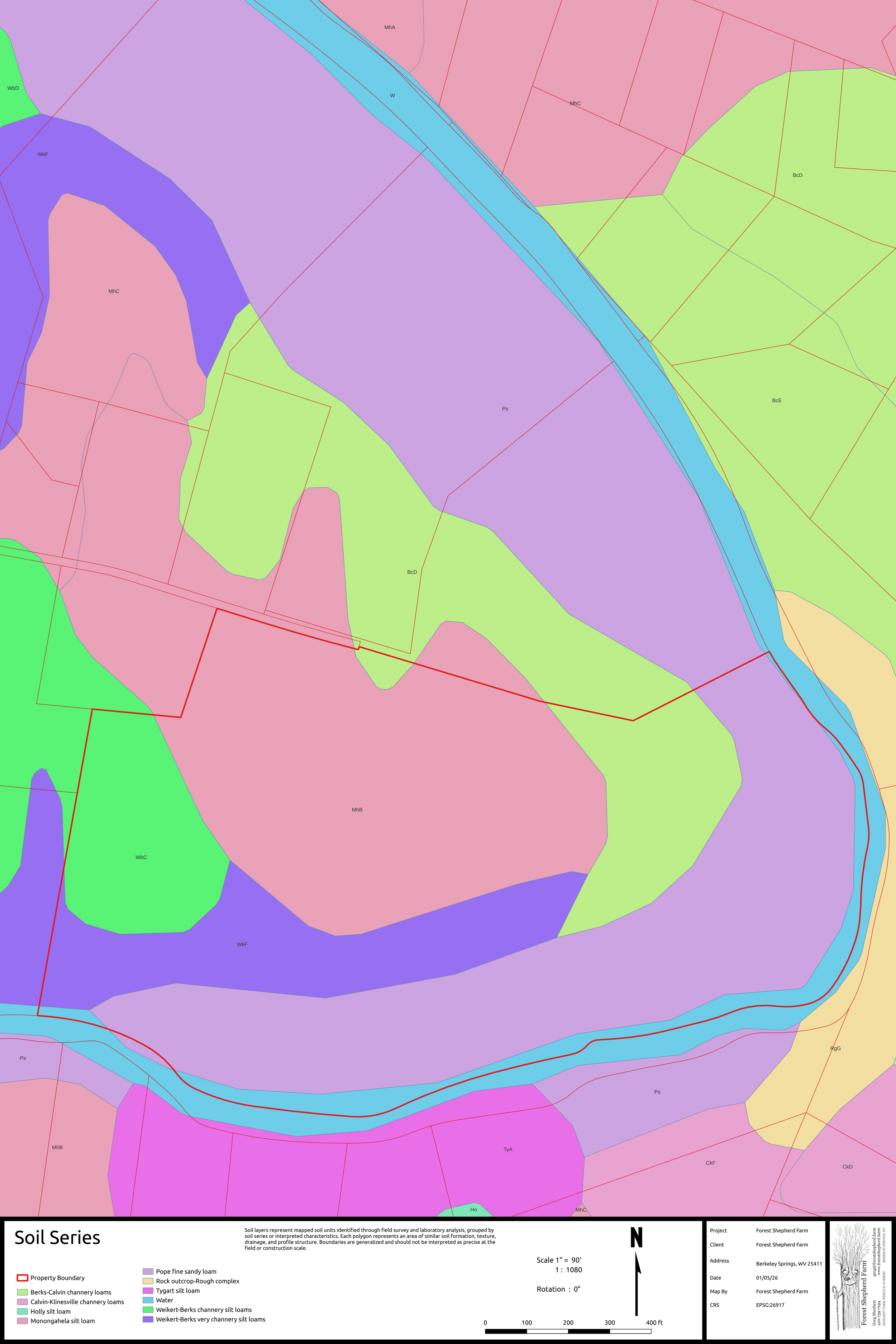
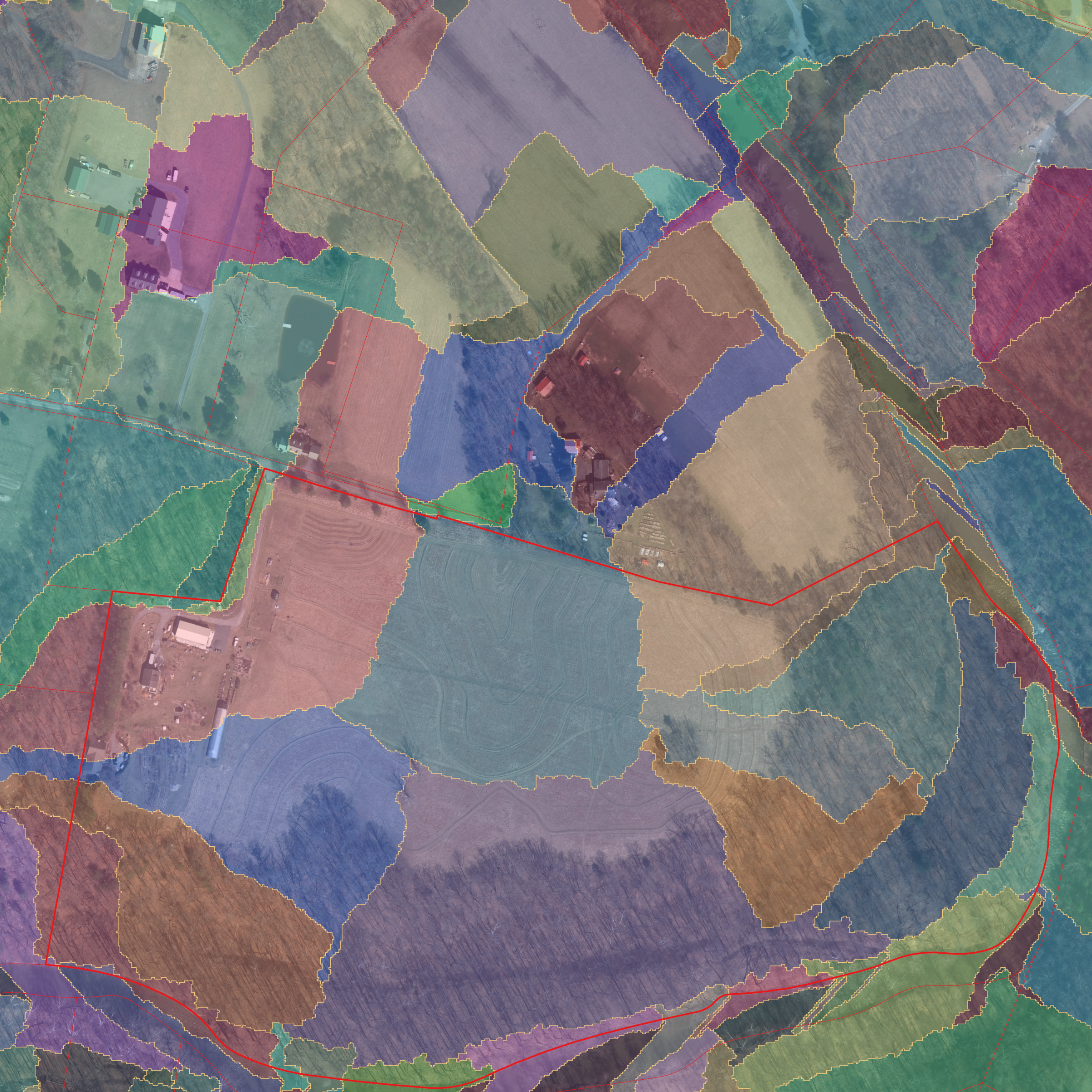
Soil Series
Soil layers represent mapped soil units identified through field survey and laboratory analysis, grouped by soil series or interpreted characteristics. Each polygon represents an area of similar soil formation, texture, drainage, and profile structure. Boundaries are generalized and should not be interpreted as precise at the field or construction scale.
-
![]()
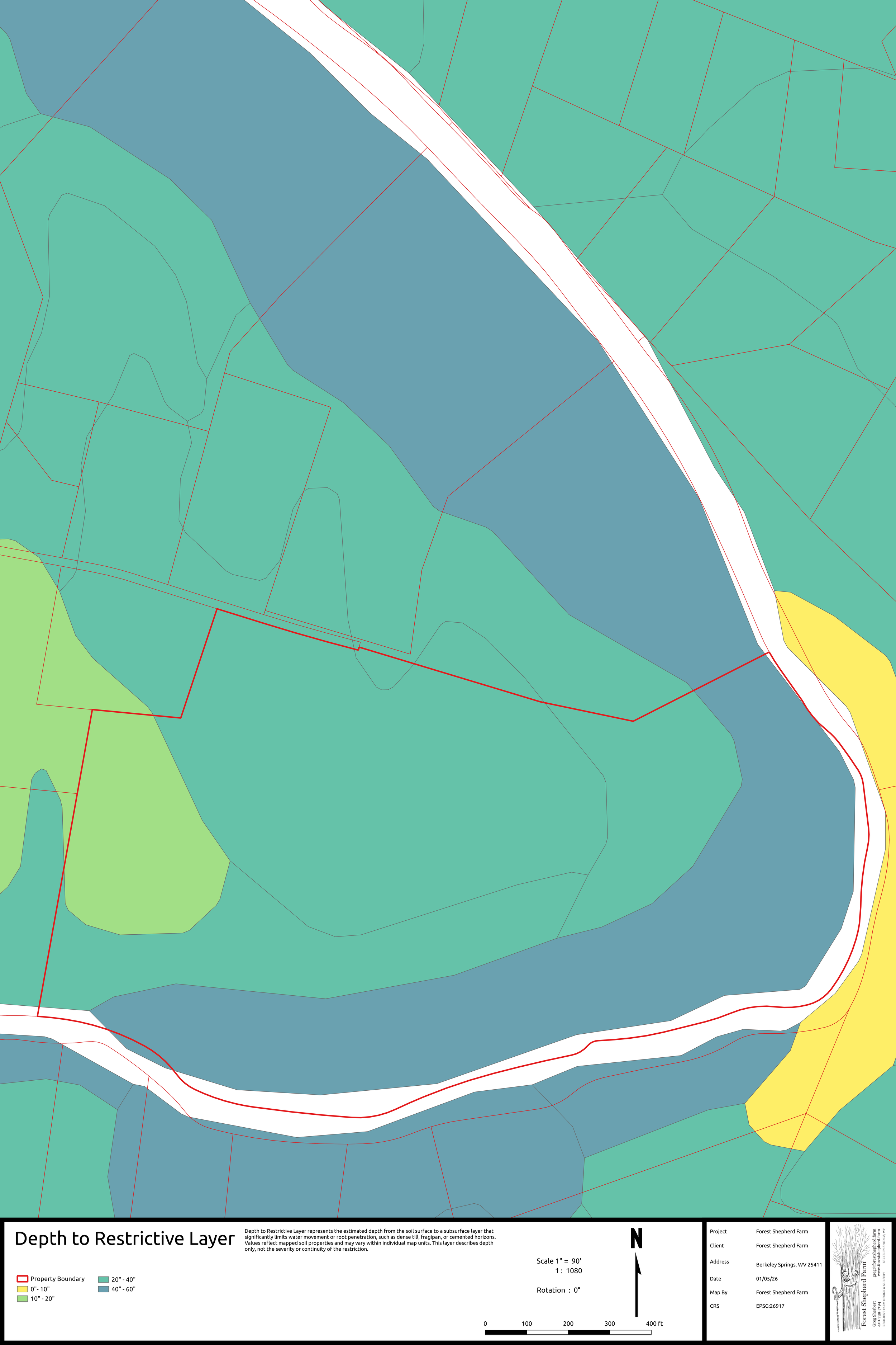
Depth to Restrictive Layer
Depth to Restrictive Layer represents the estimated depth from the soil surface to a subsurface layer that significantly limits water movement or root penetration, such as dense till, fragipan, or cemented horizons. Values reflect mapped soil properties and may vary within individual map units. This layer describes depth only, not the severity or continuity of the restriction.
-
![]()
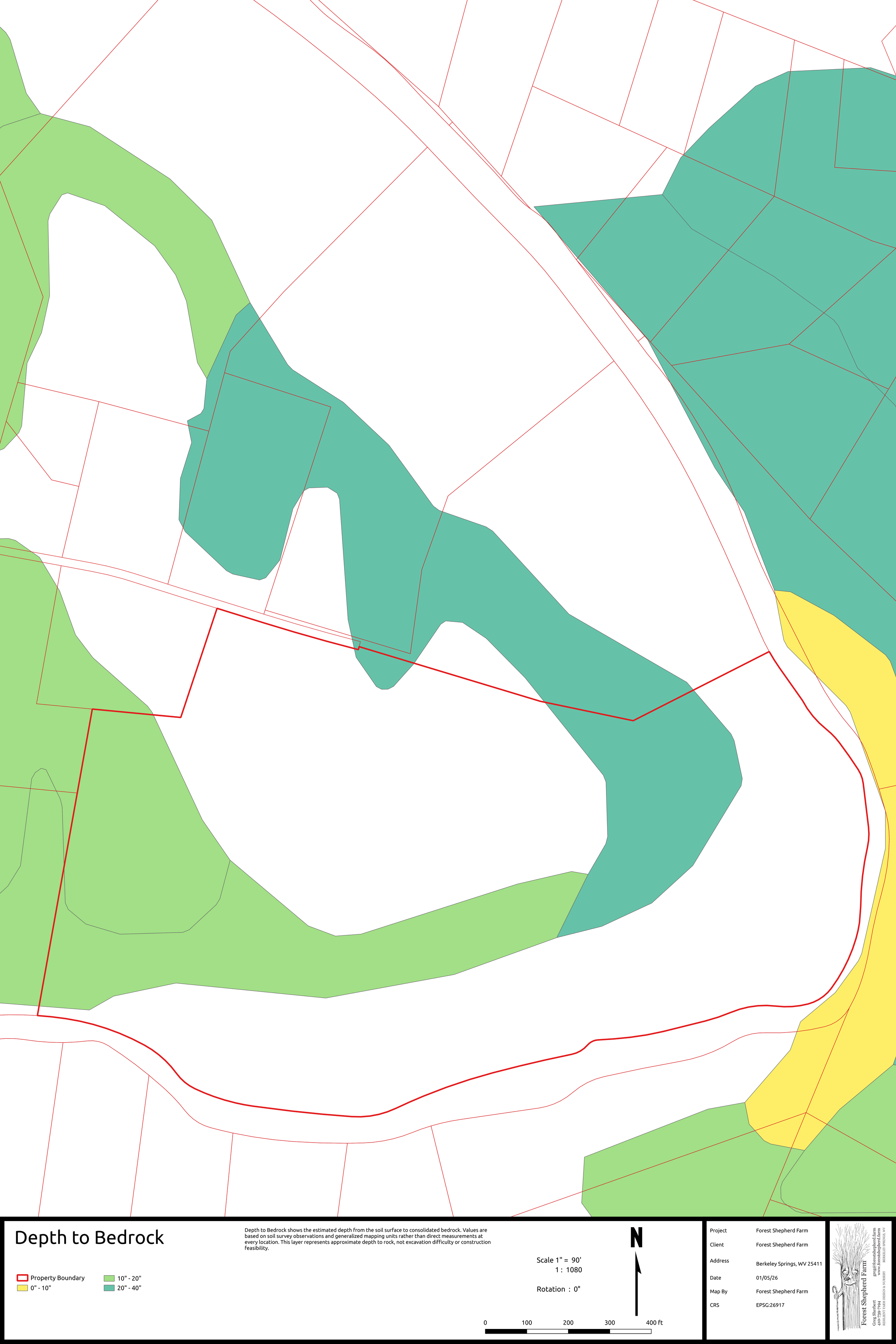
Depth to Bedrock
Depth to Bedrock shows the estimated depth from the soil surface to consolidated bedrock. Values are based on soil survey observations and generalized mapping units rather than direct measurements at every location. This layer represents approximate depth to rock, not excavation difficulty or construction feasibility.
-
![]()
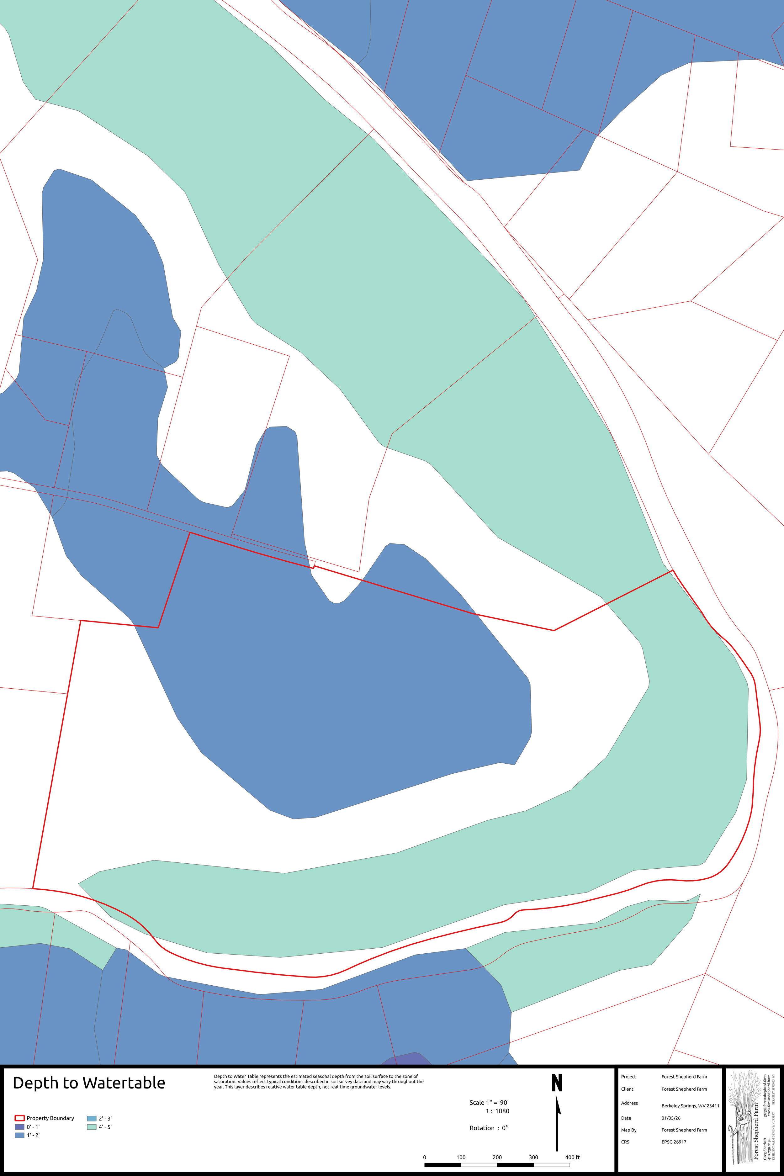
Depth to Watertable
Depth to Water Table represents the estimated seasonal depth from the soil surface to the zone of saturation. Values reflect typical conditions described in soil survey data and may vary throughout the year. This layer describes relative water table depth, not real-time groundwater levels.
-
![]()
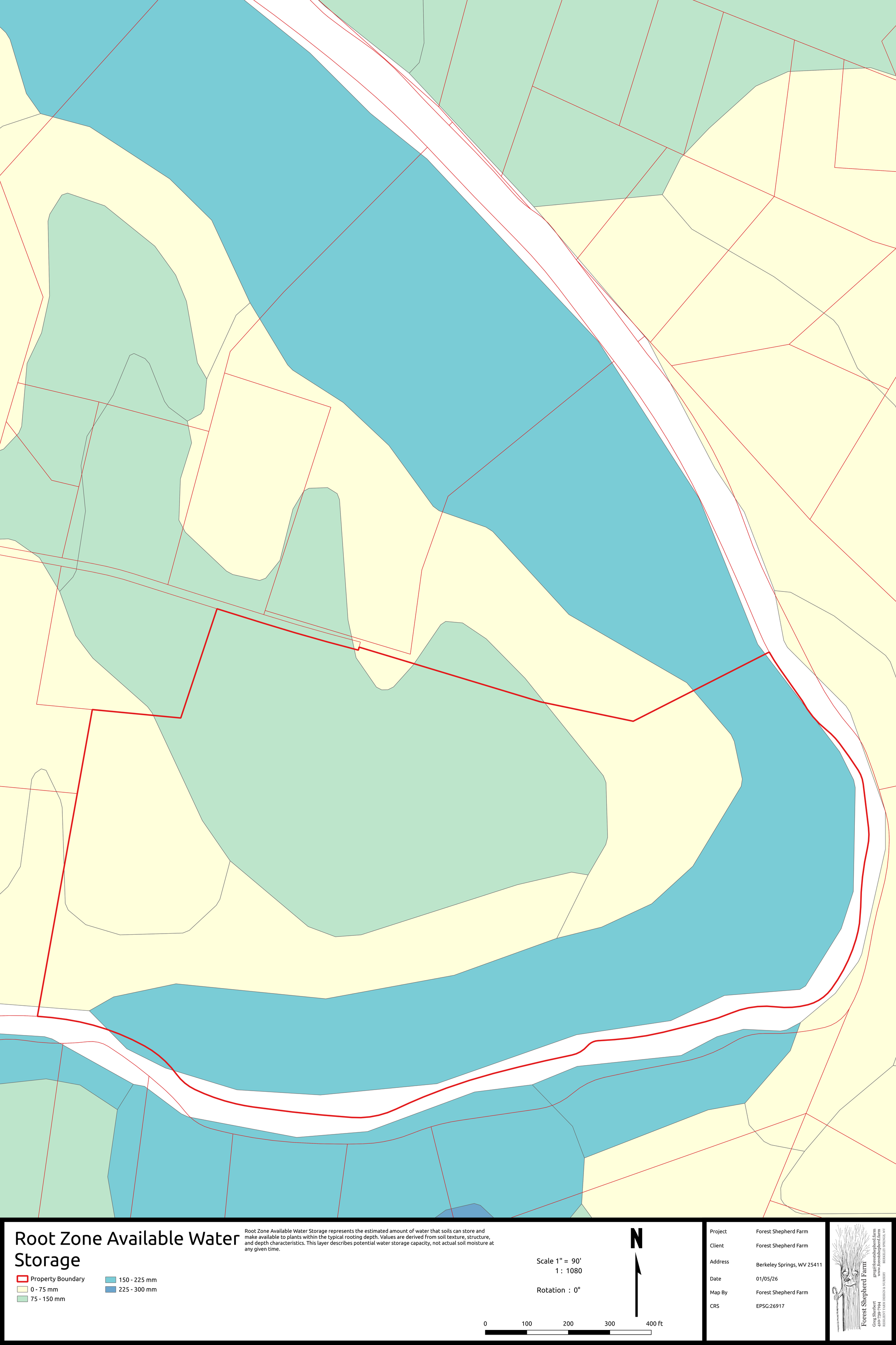
Root Zone Available Water Storage
Root Zone Available Water Storage represents the estimated amount of water that soils can store and make available to plants within the typical rooting depth. Values are derived from soil texture, structure, and depth characteristics. This layer describes potential water storage capacity, not actual soil moisture at any given time.
-
![]()
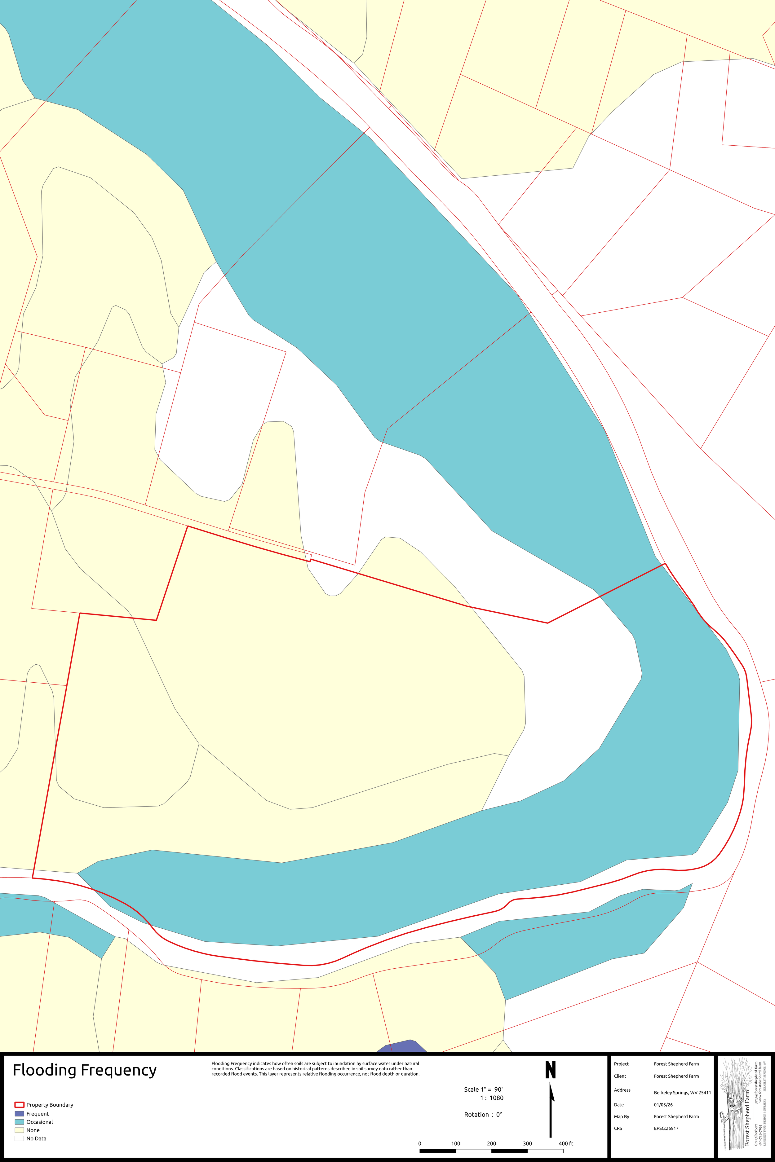
Flooding Frequency
Flooding Frequency indicates how often soils are subject to inundation by surface water under natural conditions. Classifications are based on historical patterns described in soil survey data rather than recorded flood events. This layer represents relative flooding occurrence, not flood depth or duration.
-
![]()
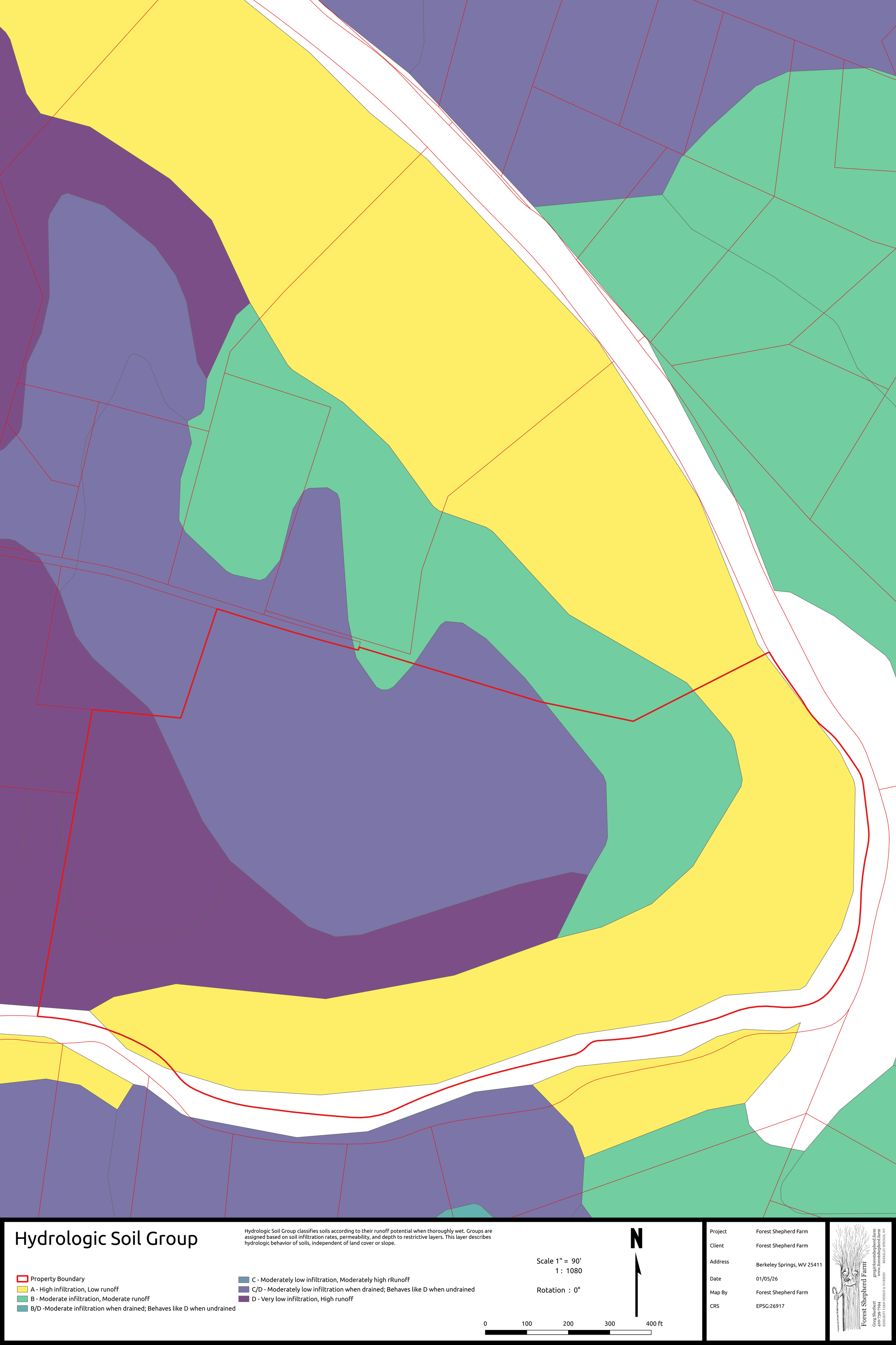
Hydrologic Soil Group
Hydrologic Soil Group classifies soils according to their runoff potential when thoroughly wet. Groups are assigned based on soil infiltration rates, permeability, and depth to restrictive layers. This layer describes hydrologic behavior of soils, independent of land cover or slope.
-
![]()
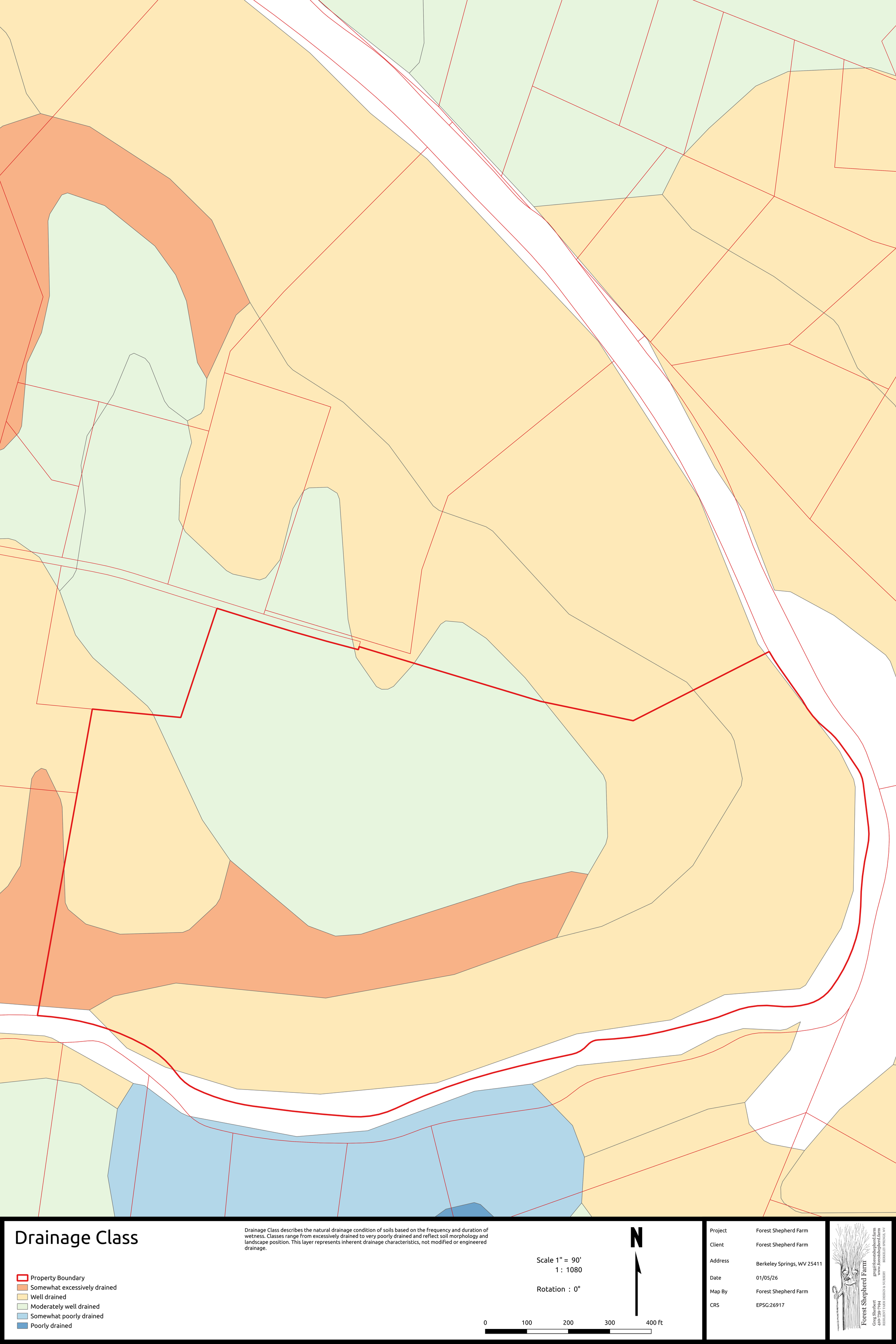
Drainage Class
Drainage Class describes the natural drainage condition of soils based on the frequency and duration of wetness. Classes range from excessively drained to very poorly drained and reflect soil morphology and landscape position. This layer represents inherent drainage characteristics, not modified or engineered drainage.
-
![]()
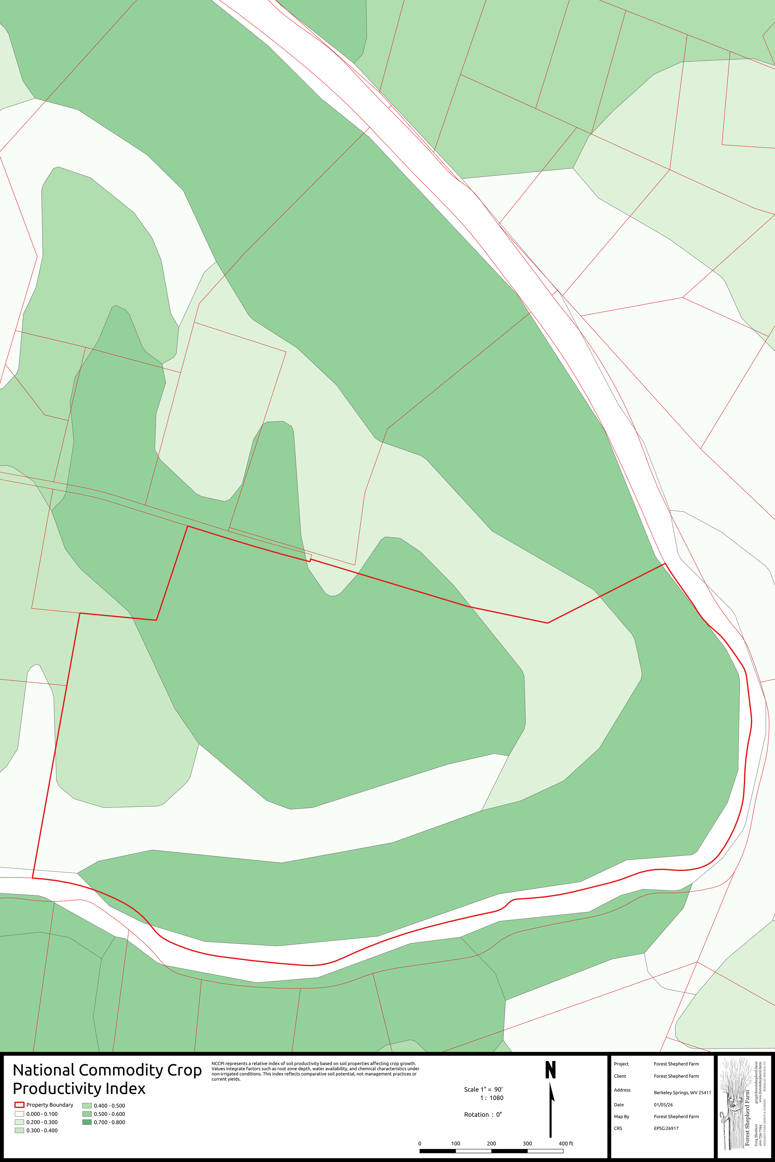
National Commodity Crop Productivity Index
NCCPI represents a relative index of soil productivity based on soil properties affecting crop growth. Values integrate factors such as root zone depth, water availability, and chemical characteristics under non-irrigated conditions. This index reflects comparative soil potential, not management practices or current yields.
-
![]()
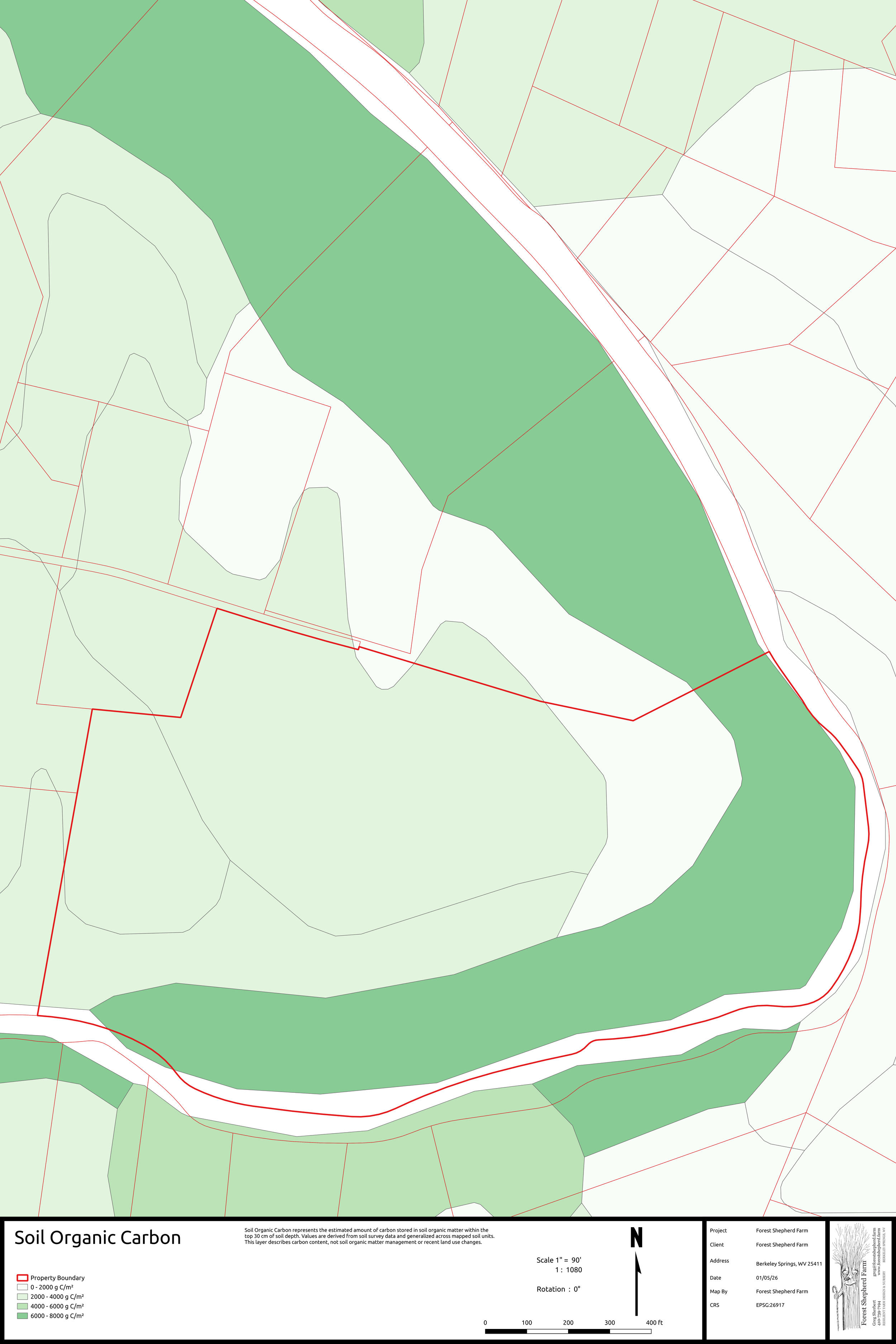
Soil Organic Carbon
Soil Organic Carbon represents the estimated amount of carbon stored in soil organic matter within the top 30 cm of soil depth. Values are derived from soil survey data and generalized across mapped soil units. This layer describes carbon content, not soil organic matter management or recent land use changes.
-
![]()
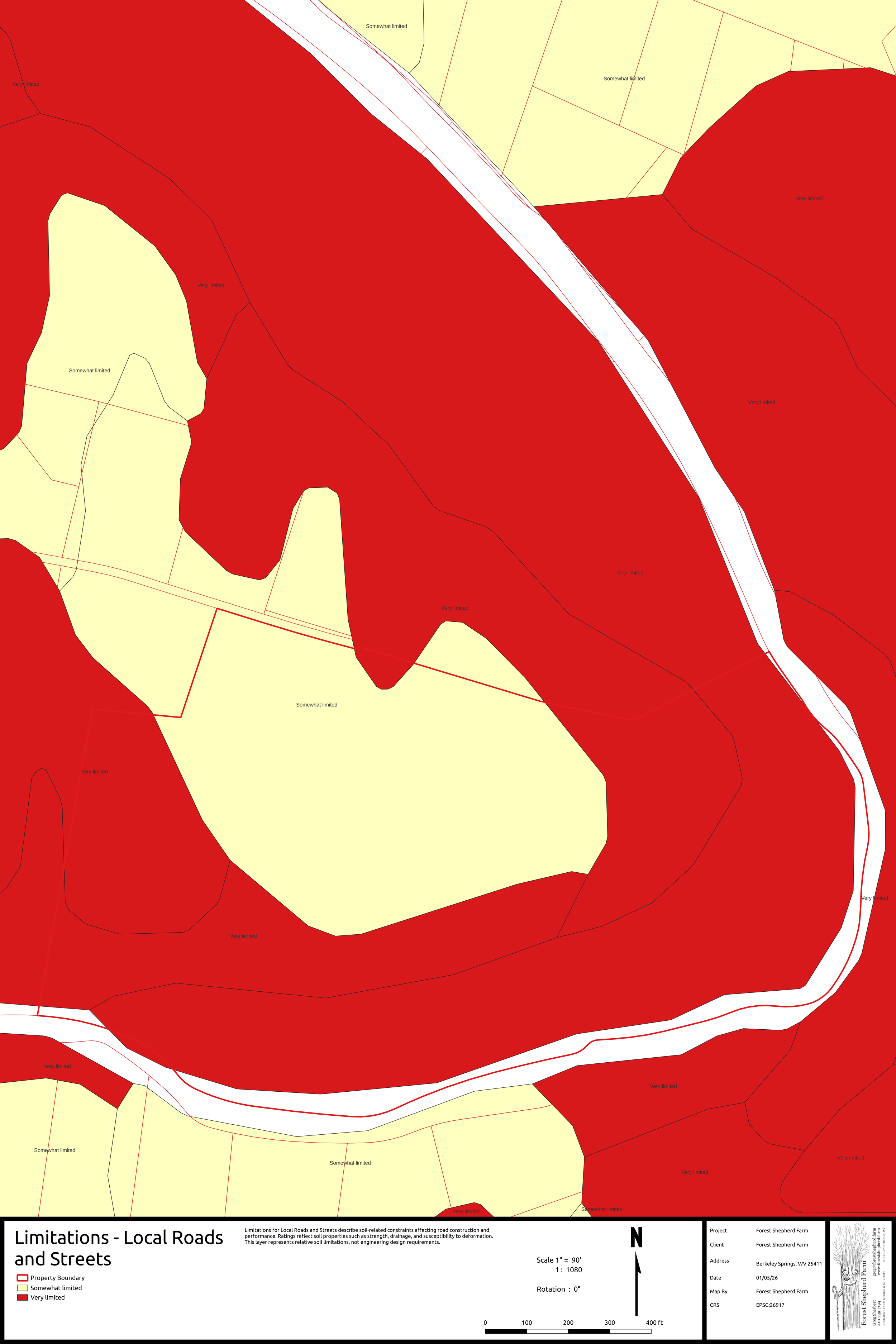
Engineering Layers - Limitations - Local Roads & Streets
Limitations for Local Roads and Streets describe soil-related constraints affecting road construction and performance. Ratings reflect soil properties such as strength, drainage, and susceptibility to deformation. This layer represents relative soil limitations, not engineering design requirements.
-
![]()
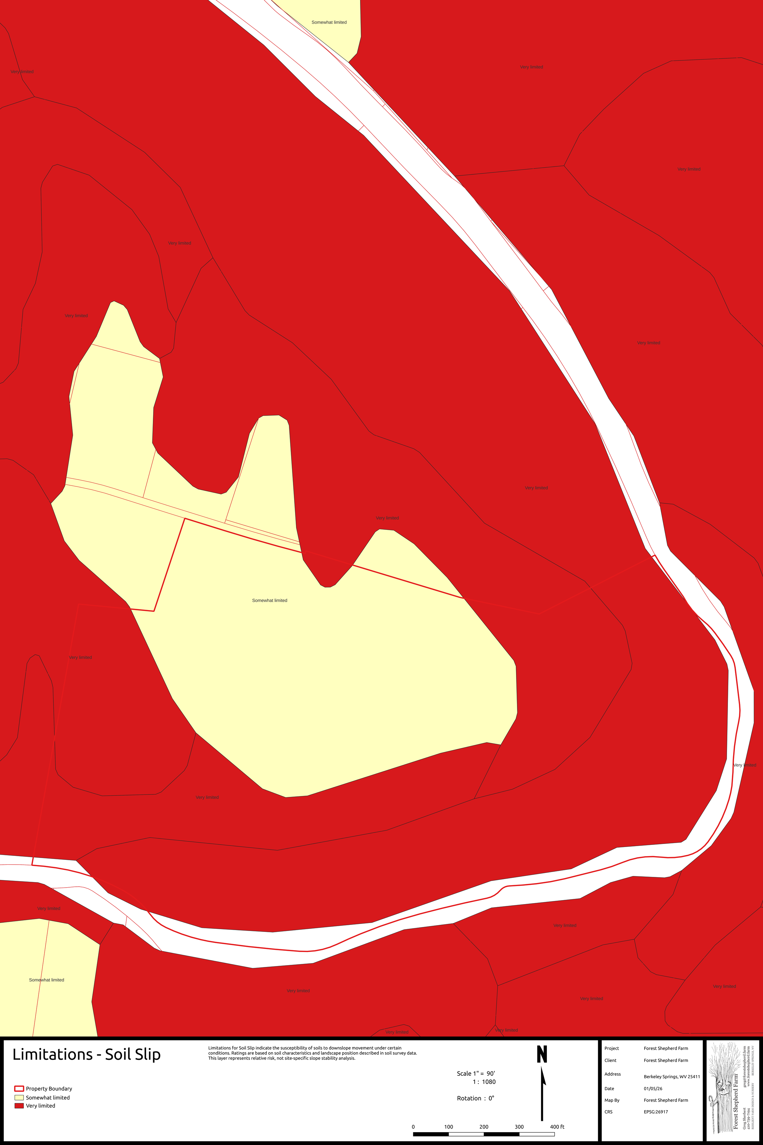
Enginneering Layers - Limitations - Soil Slip
Limitations for Soil Slip indicate the susceptibility of soils to downslope movement under certain conditions. Ratings are based on soil characteristics and landscape position described in soil survey data. This layer represents relative risk, not site-specific slope stability analysis.
-
![]()
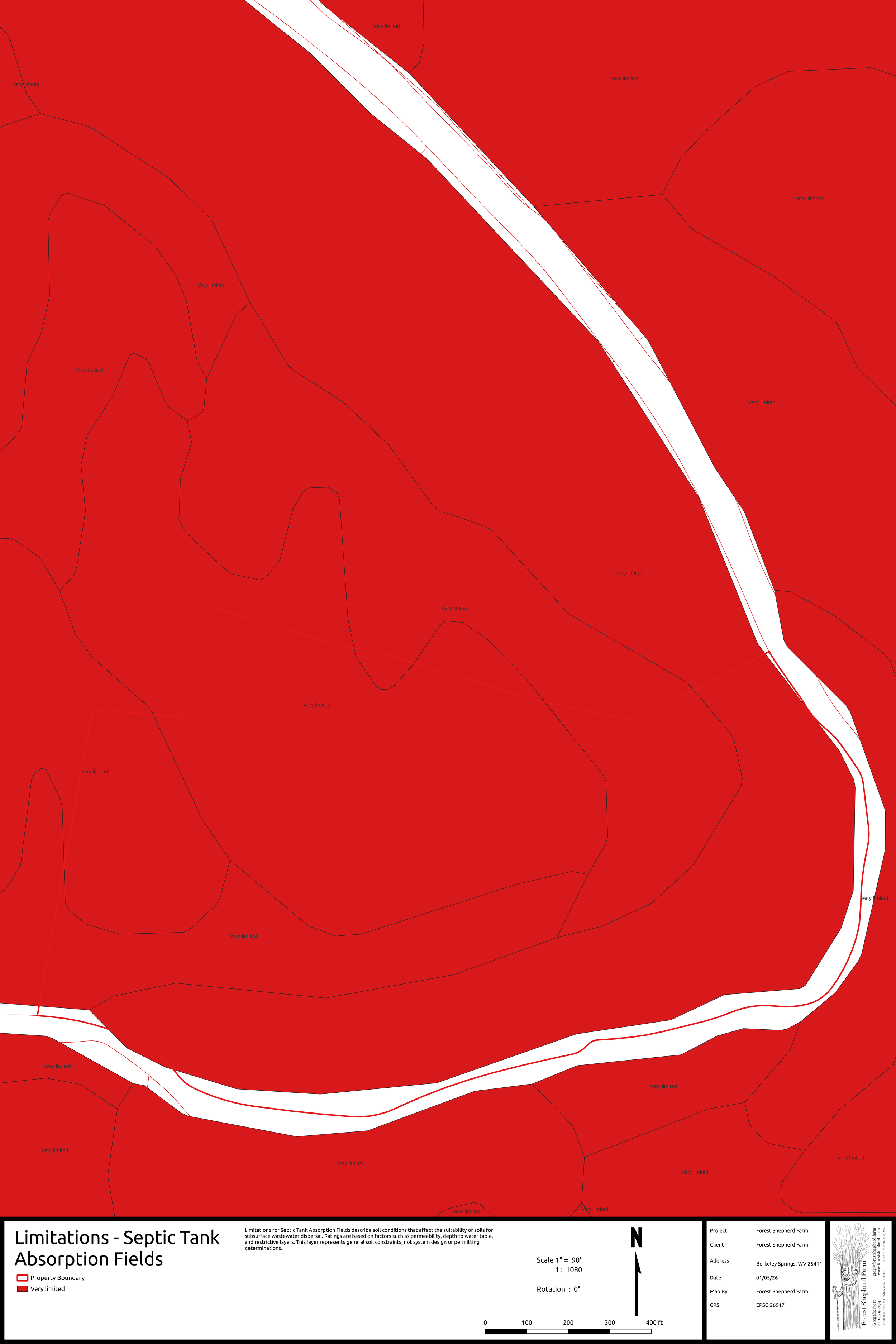
Engineering Layers - Limitations - Septic Tank Absorbtion Fields
Limitations for Septic Tank Absorption Fields describe soil conditions that affect the suitability of soils for subsurface wastewater dispersal. Ratings are based on factors such as permeability, depth to water table, and restrictive layers. This layer represents general soil constraints, not system design or permitting determinations.
-
![]()
Engineering Layers - Limitations - Dwellinging without Basements
Limitations for Dwellings without Basements describe soil-related constraints affecting slab-on-grade or shallow foundation construction. Ratings are based on soil properties influencing stability, drainage, and wetness. This layer represents general soil limitations, not site-specific engineering evaluation.
-
![]()
Engineering Layers - Limitations - Dwellings with Basements
Limitations for Dwellings with Basements describe soil-related factors affecting below-grade construction. Ratings consider conditions such as drainage, flooding, and depth to restrictive layers. This layer represents relative soil limitations, not construction feasibility or code compliance.


What You Get
Each Basemaps package includes multiple formats so the data can be used across different disciplines and software environments. You will be provided with a link to a Dropbox folder containing your files.
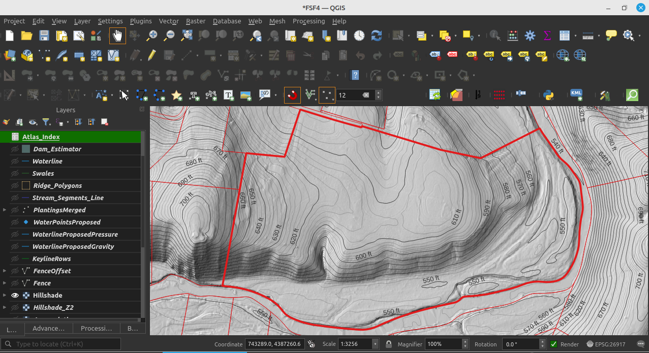
1. Full QGIS Project
A complete QGIS project with:
Organized layer structure
Consistent symbology
Pre-built map layouts
Atlas-ready print pages with multiple themes
All vector data stored in a single GeoPackage
All raster data stored as GeoTIFFs
2. Google Earth Pro Overlays
Styled KMZ overlays for easy viewing and sharing
Includes:
Raster overlays (terrain, hydrology, relief)
Simplified vector layers (streams, contours, parcels where applicable)
Intended for:
Clients
Stakeholders
Non-GIS collaborators
Important:
Google Earth Pro layers are for viewing and communication only and are not intended for measurement-grade work.
3. AutoCAD Users
A curated DXF export intended for:
Architects
Engineers
Surveyors
CAD-based design workflows
Includes:
Contours (both raw and smoothed, cartographic grade)
Streams and hydrology vectors
Ridges, basins, and relevant terrain structure
Selected soils layers with engineering relevance
Excludes:
Analysis-only layers
Anything that unnecessarily increases file size
Raster layers remain available separately as GeoTIFFs for use as CAD underlays where supported.
4. Printable PDFs
Print-ready map sheets matching the QGIS project
Consistent cartography across themes
Suitable for:
Meetings
Field use
Documentation
Data Sources and Methods
All basemaps are derived from public, authoritative datasets and processed using transparent, repeatable methods. These datasets are not always available in all locations.
Terrain and Hydrology
USGS LiDAR-derived elevation models
Terrain derivatives such as:
Hillshade / relief
Slope
Flow accumulation
Topographic Wetness Index (TWI)
Geomorphometric landform classification
Hydrologic features extracted from surface topography, not hand-drawn
These layers support both farming applications (water movement, erosion, access) and building applications (slope, drainage, and site constraints).
Soils (NRCS / SSURGO)
NRCS SSURGO soil polygons
Included attributes focus on:
Agricultural relevance
Engineering relevance (for example, building limitations, soil slip potential, and septic suitability)
Soil data is presented as mapped, without reinterpretation or scoring
This dataset can be difficult to work with directly in GIS software, so it has been structured to be easier to use. Google Earth Pro users will need an internet connection to access NRCS soil web layers.
Soil boundaries reflect survey-scale mapping, not field-staked precision.
Land Cover
Derived from ESA Land cover https://worldcover2020.esa.int/downloader
This is an approximation based on a 10 meter resolution raster
Land cover has been converted to vector polygons and smoothed for a more natural look that is easy to adjust
Buildings, roads, and other features are derived from Open Street Maps
These features may not be available everywhere
Imagery
High quality imagery will be included if available
What This Is — and Is Not
This is:
A professional basemap foundation
A decision-support dataset
A shared spatial reference for interdisciplinary teams
Appropriate for planning, design, and feasibility work
This is not:
A boundary survey
An engineering design
A regulatory submission
A replacement for site-specific testing
All outputs are intended for planning and communication, not legal determination.
Typical Use Cases
Farmers planning water movement, access, and long-term land use
Designers developing keyline, agroforestry, or restoration concepts
Architects evaluating site constraints and opportunities
Engineers assessing terrain, drainage, and soils context
Project teams that need a shared spatial reference
This service provides a complete, high-resolution basemap package for landowners, designers, architects, engineers, and farmers working at the property and watershed scale.
This is not a single map.
It is a coherent spatial dataset, intended for analysis, design, communication, and downstream professional use.
Pricing
$150 per property (flat rate, full package)
$75 for Morgan County, WV
Intake and Turnaround
Projects begin by filling out the intake form
Client-provided parcel boundaries are preferred in KMZ format
(county parcels may be used when available)Typical turnaround is a few days, depending on scope and data availability